Aydın GIS-Based Elec. Water Man. System
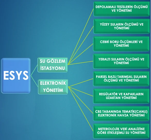
Our Electronic Water Management System Project is a main management system where the monitoring, control, analysis and reporting of many measurement data in different categories are accumulated and managed in a single database, and where mechanics and software are combined.
Aydin GIS Based Electronic Water Management System
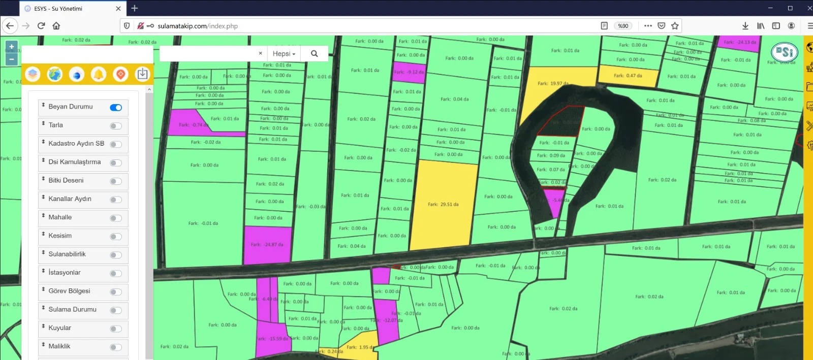
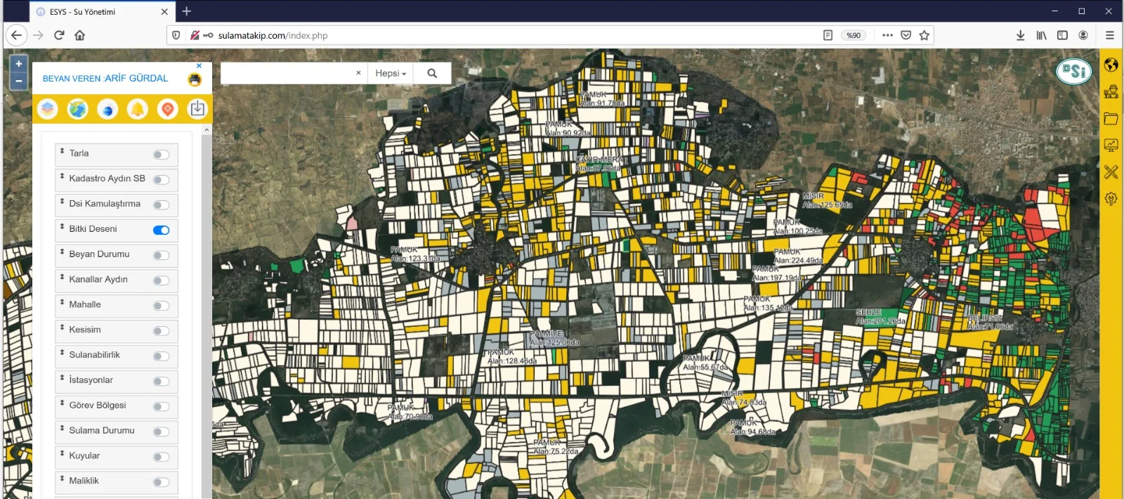
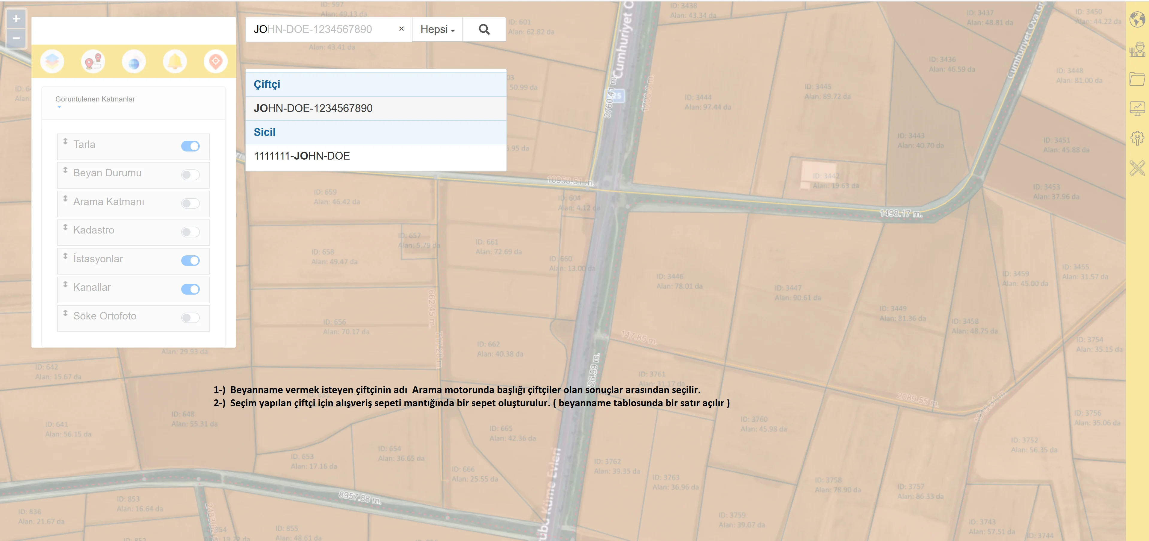
Aydın Electronic Water Management System (ESYS) offers a multi-layered management infrastructure where mechanics are integrated with software in order to ensure efficient management of water resources. This system offers a solution where measurement data in different categories are collected together and processed in a single database. After the software infrastructure is completed, appropriate devices are placed at each measurement point and these devices instantly monitor critical data related to water management such as water levels, flow rate, and pressure. In addition, measurement points and parceling information are integrated into the system with orthophoto studies conducted in the application field. This data is processed numerically and detailed information about each point is presented in the system. The system not only monitors data but also analyzes this data to optimize water resources. It also includes advanced reporting and data visualization tools so that the most accurate decisions can be made at every step of water management. Aydın GIS-Based Electronic Water Management System offers an integrated approach at every stage of water management, ensuring more efficient use of water resources. Thanks to software and hardware integration, data is instantly collected, analyzed, and presented to users so that the most accurate decisions can be made. This system aims not only to monitor data but also to ensure the sustainability of water, thus making the management of water resources more efficient and safe.
Project Implementation Stages
1. Stage Installation of Infrastructure and Measurement Systems
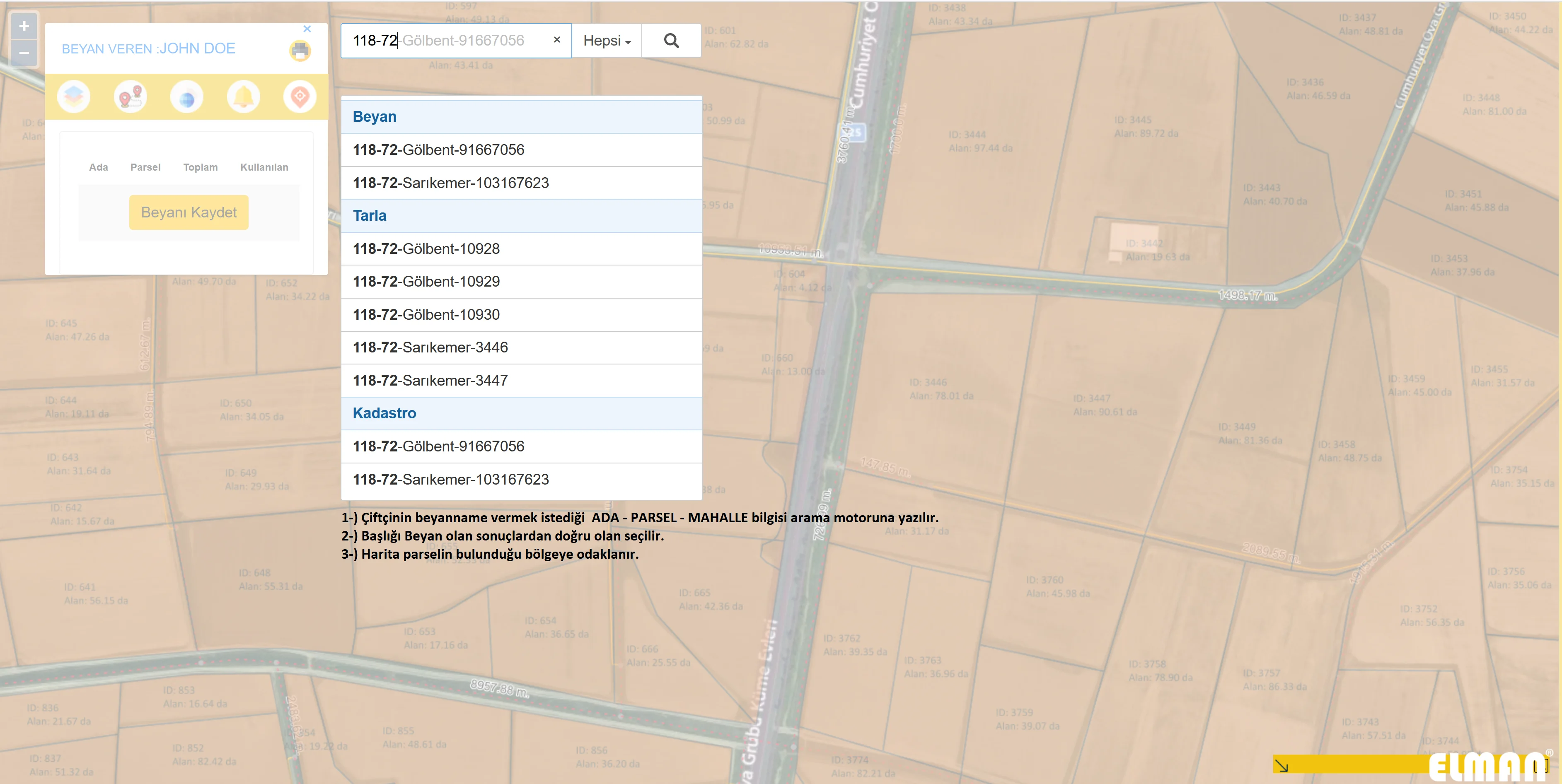
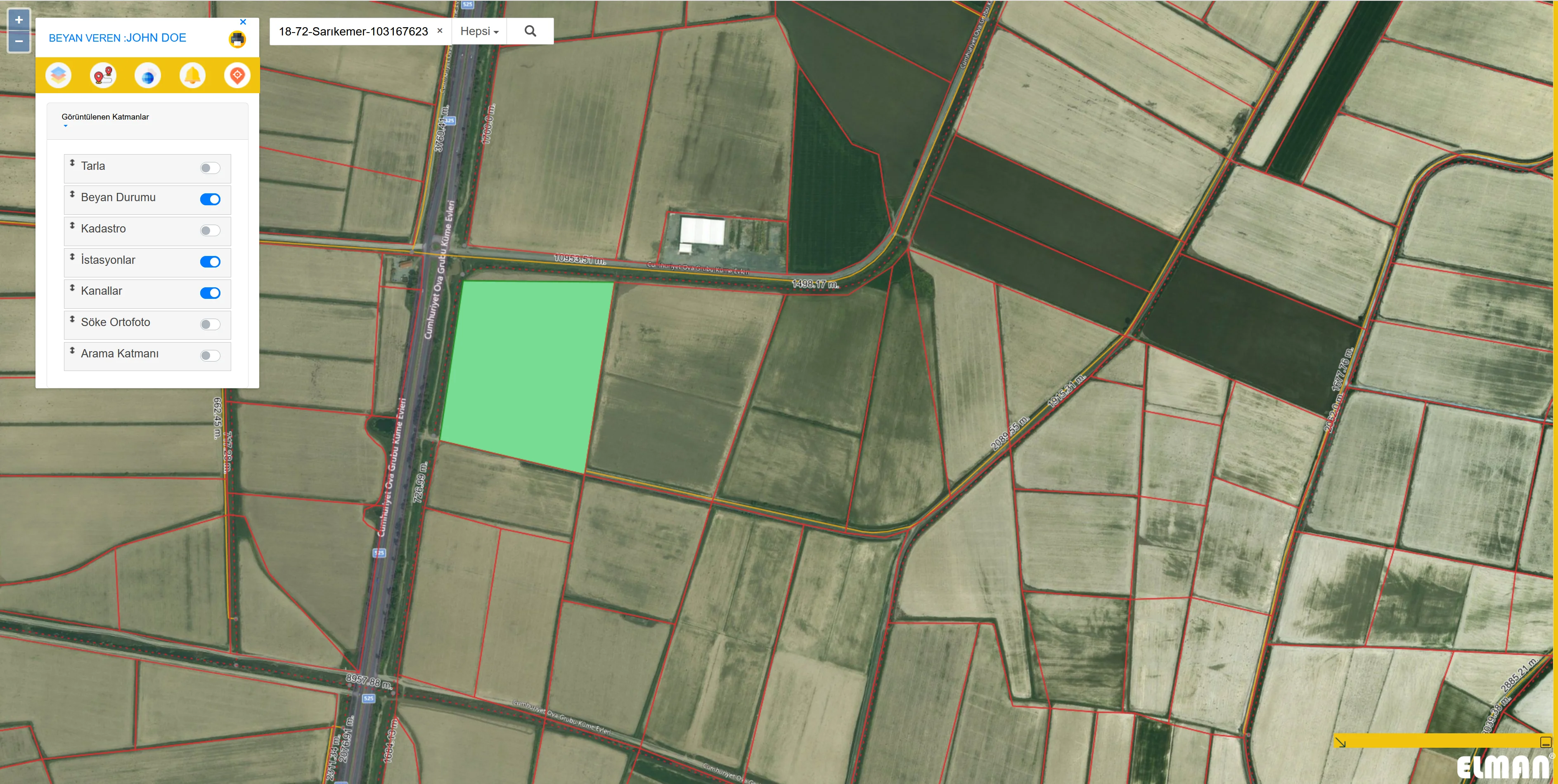
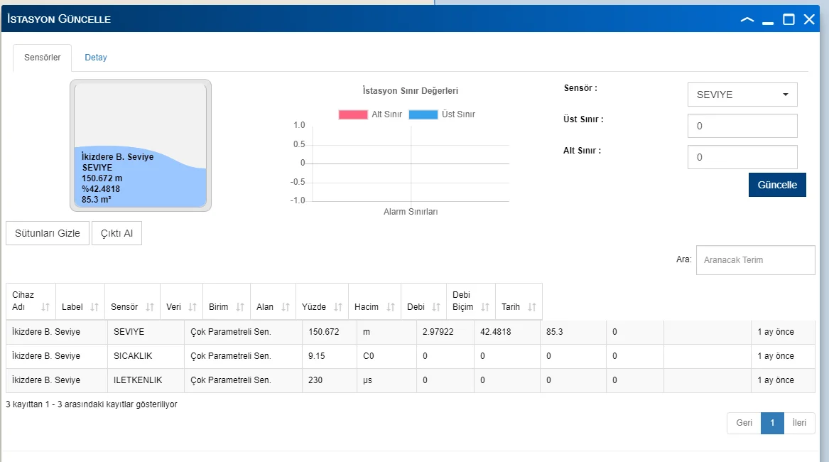
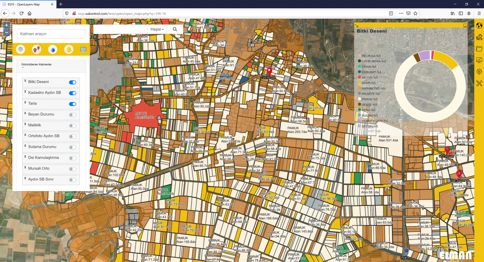
This stage is the establishment of the basic infrastructure of the system. First, the measurement systems required for water management are installed in the designated areas. These measurement devices measure parameters such as water levels, flow, temperature, pH, and this data is collected instantly in a central system. At the same time, orthophoto studies of the application area are carried out. Thanks to this study, measurement points and boundaries on the land are determined and digitized on the map. All this data is loaded into the system's database and the numerical information of each measurement point is processed and made available later.
2. Stage Data Processing and Numerical Modeling
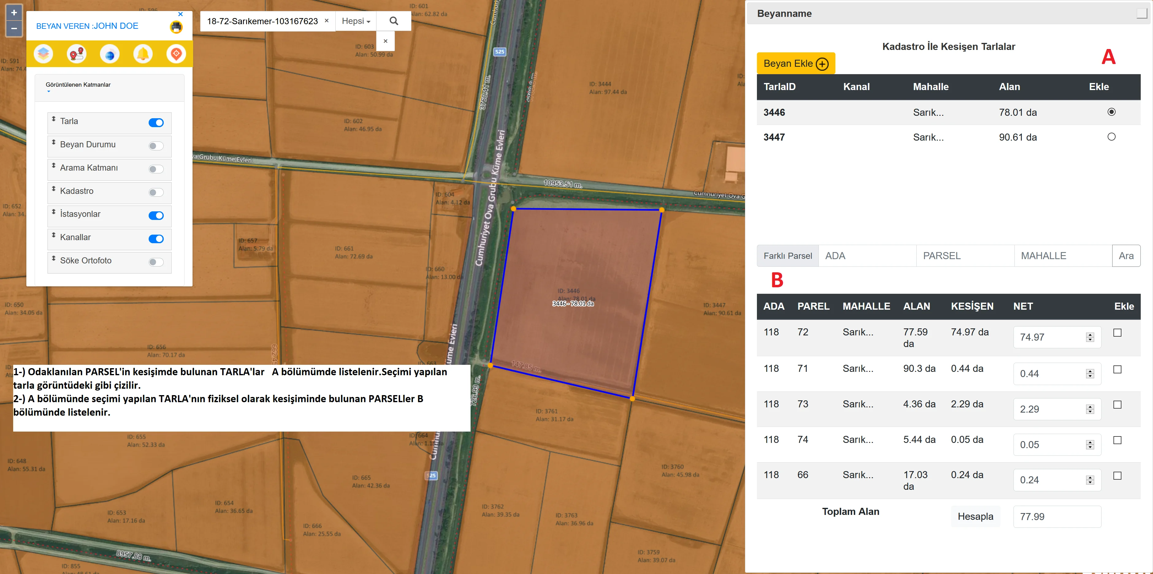
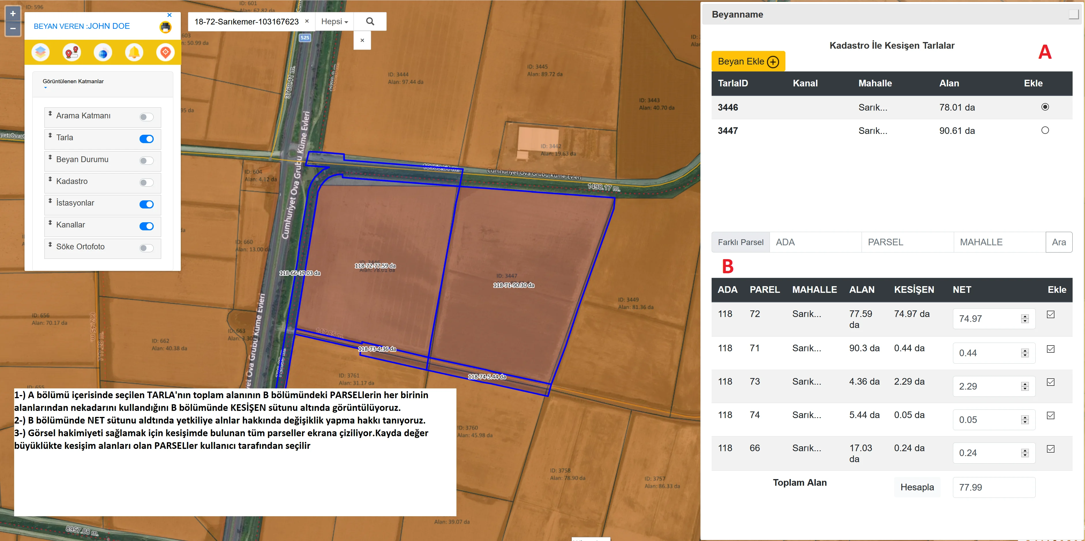
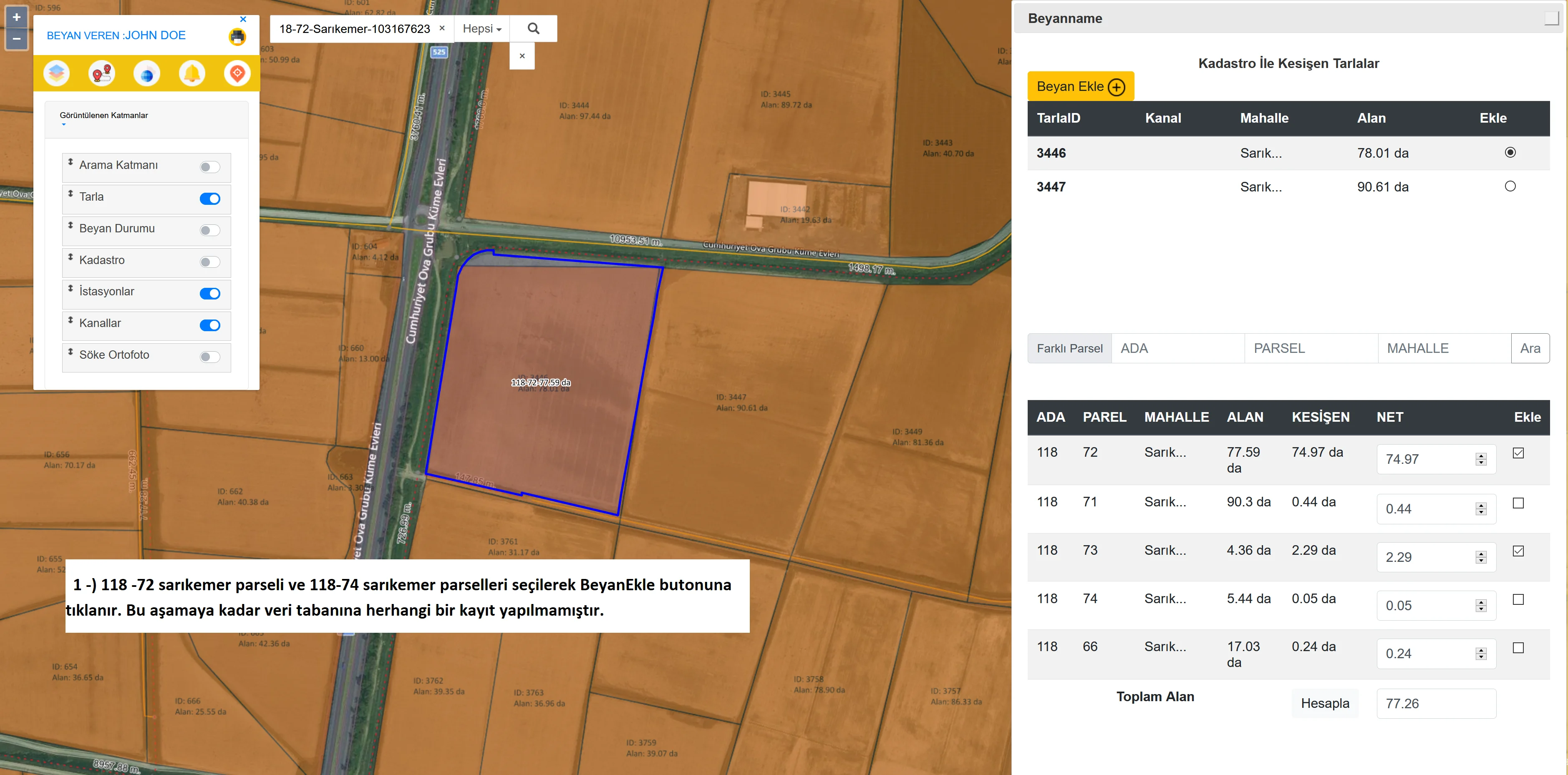
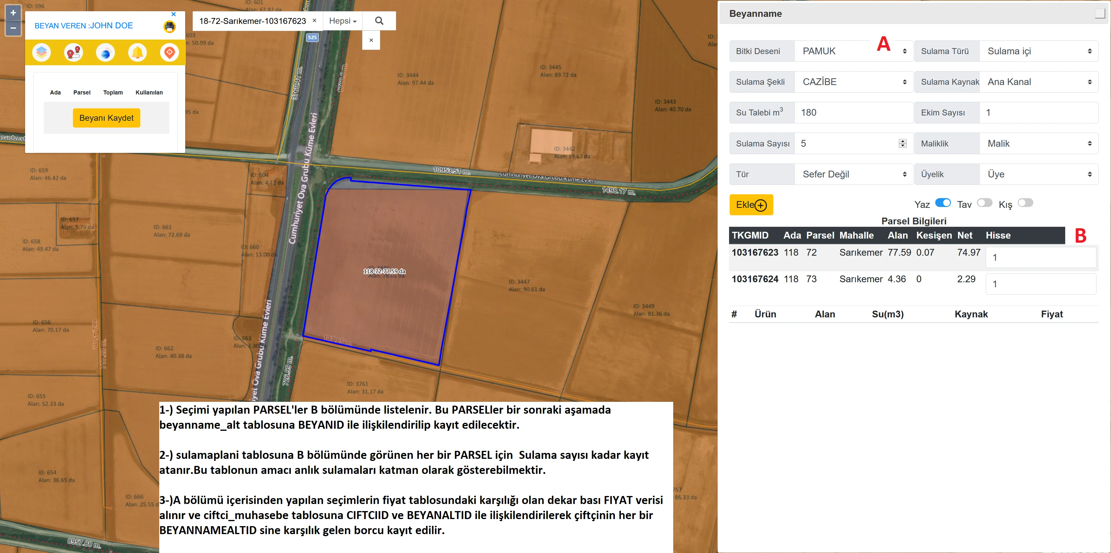
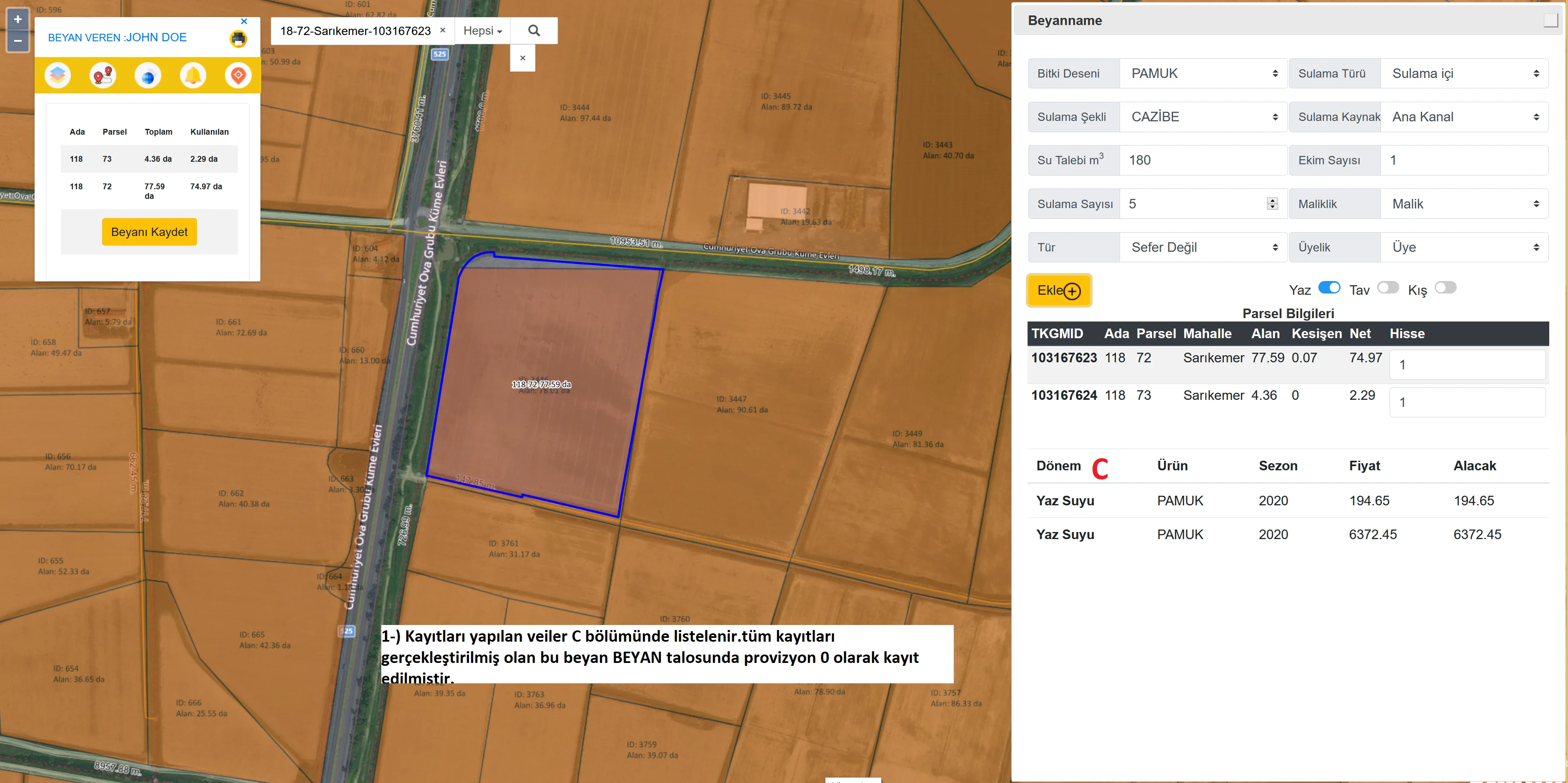
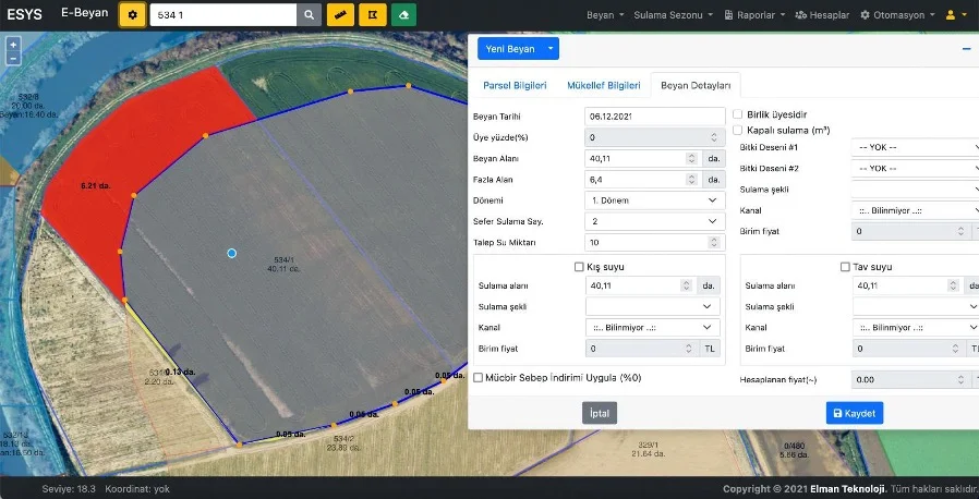
The second stage is the digital processing and analysis of the uploaded data. The data obtained from the orthophoto study is associated with the parceling information determined on the map. At this point, the spatial analysis of the data is performed using the Geographic Information System (GIS). The details of each measurement point are processed digitally and each data point shown on the system is optimized on an area basis. In this way, detailed reports can be created on the status of each water source and irrigation area. In addition, in this process, elements such as water usage data, water reserves and climatic factors are evaluated and future water needs are estimated. The analyses performed provide the necessary data to manage water resources efficiently.
3. Stage Integrated Management and Reporting
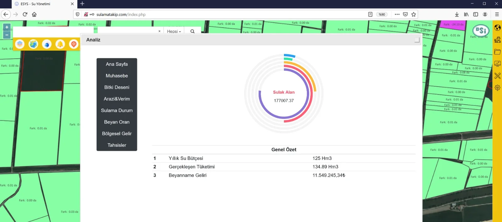
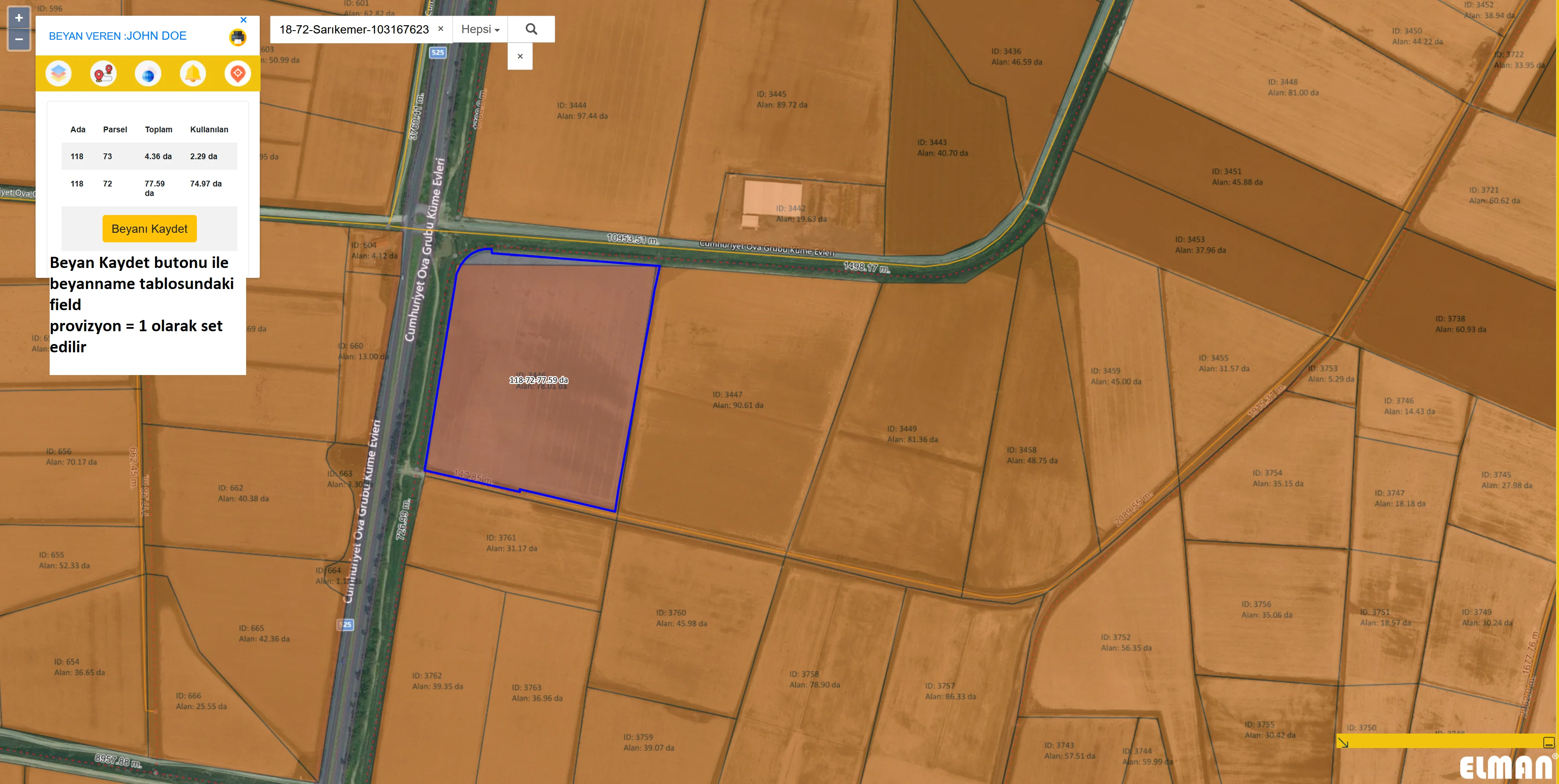
The final stage is to integrate all data and create decision support mechanisms based on this data. Here, water levels, flow rates, irrigation needs and other critical data are analyzed and detailed reports are prepared on this data. These reports provide instant and historical information to water management authorities, allowing them to make the right water management decisions. Real-time monitoring and reporting tools monitor changes in water levels, current water stocks, irrigation needs and other parameters, ensuring efficient use of water. In addition, suggestions are provided through the system to optimize water use, thus preserving the sustainability of local water resources.
Aydın GIS-Based Elec. Water Man. System Products We Use