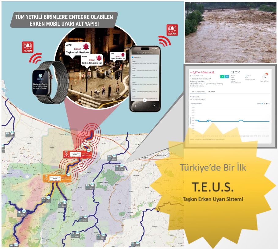
Taşkın Erken Uyarı Sistemi (TEUS) ®
ESYS FLOOD EARLY WARNING SYSTEM
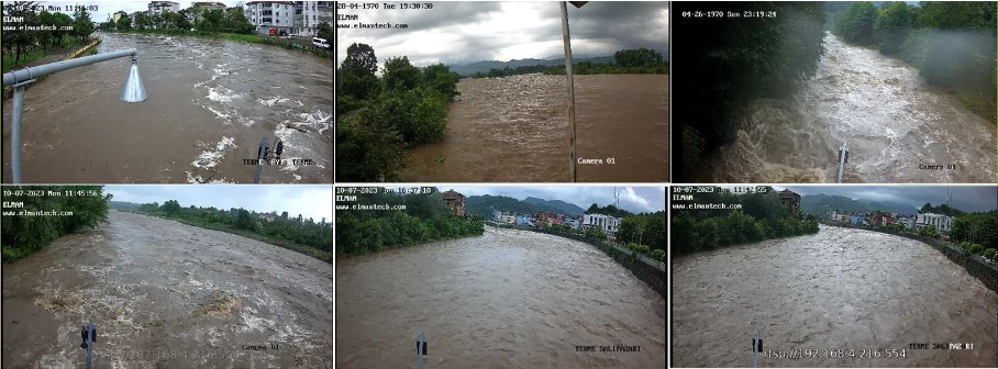
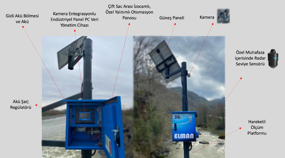
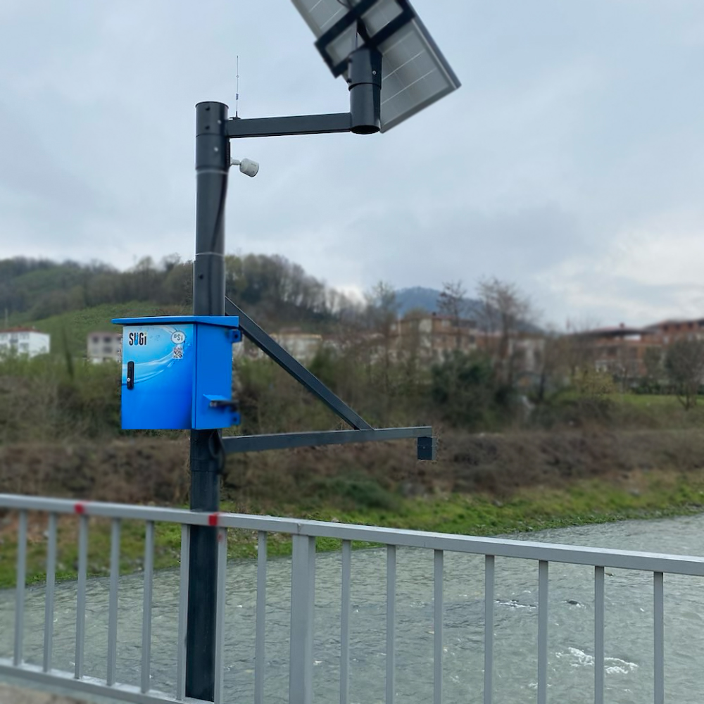
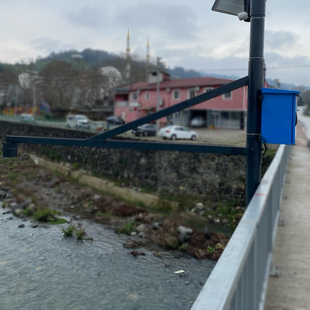
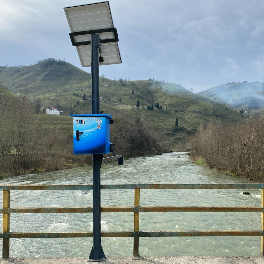
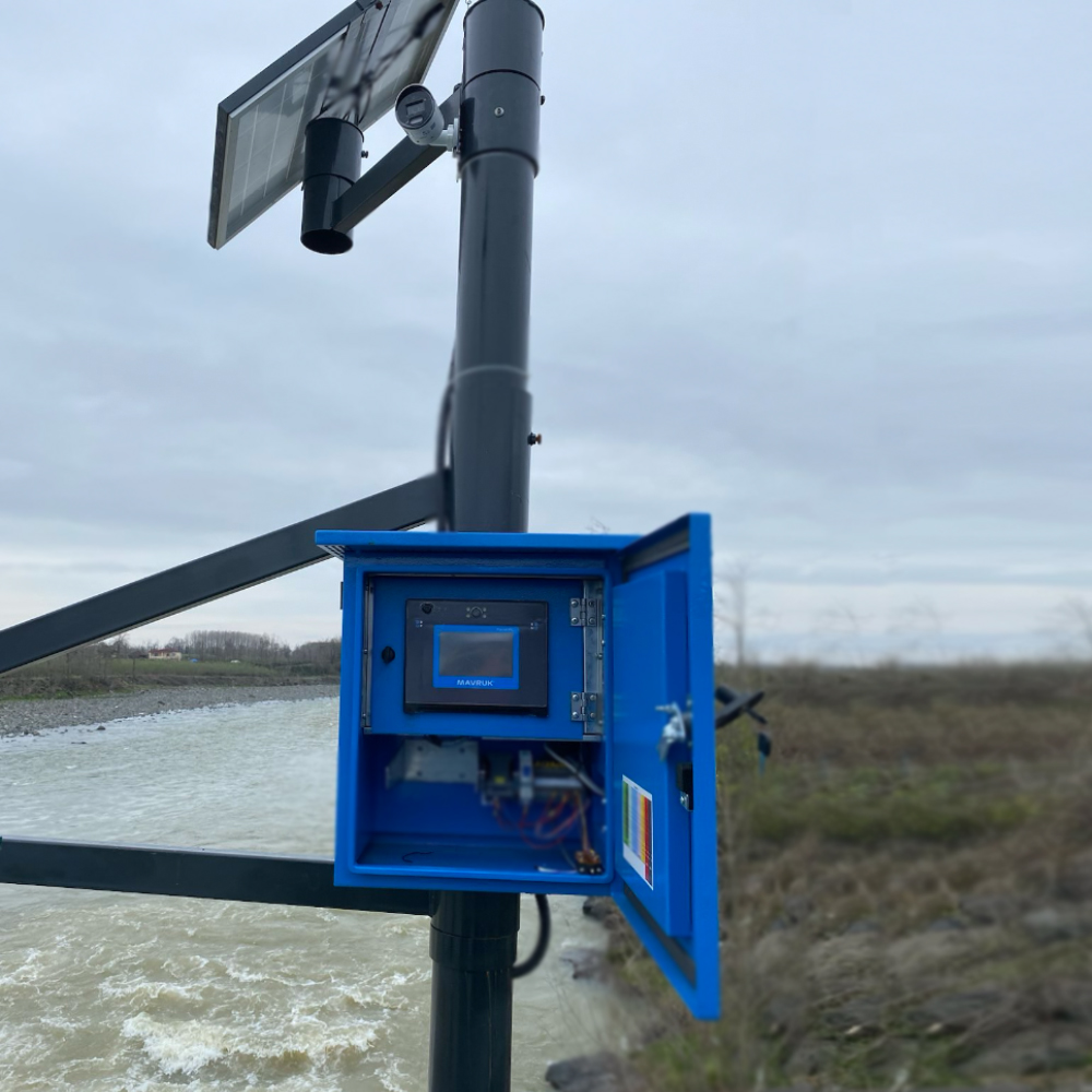
It has been implemented as Turkey's first live video monitoring-enabled flood early warning and alert project. 35 different flood-risk points can be observed online, with live video streaming provided for six critical locations. With this system, non-contact water level measurement systems have been installed between the upstream and downstream points of rivers at risk of flooding. Additionally, live video monitoring systems have been integrated at the most critical points, providing visual control over flood-prone areas. The system monitors both hydrological and meteorological data in real-time. In addition, cameras at critical points allow real-time image processing and transmission, enabling cross-checking of data in real-time.
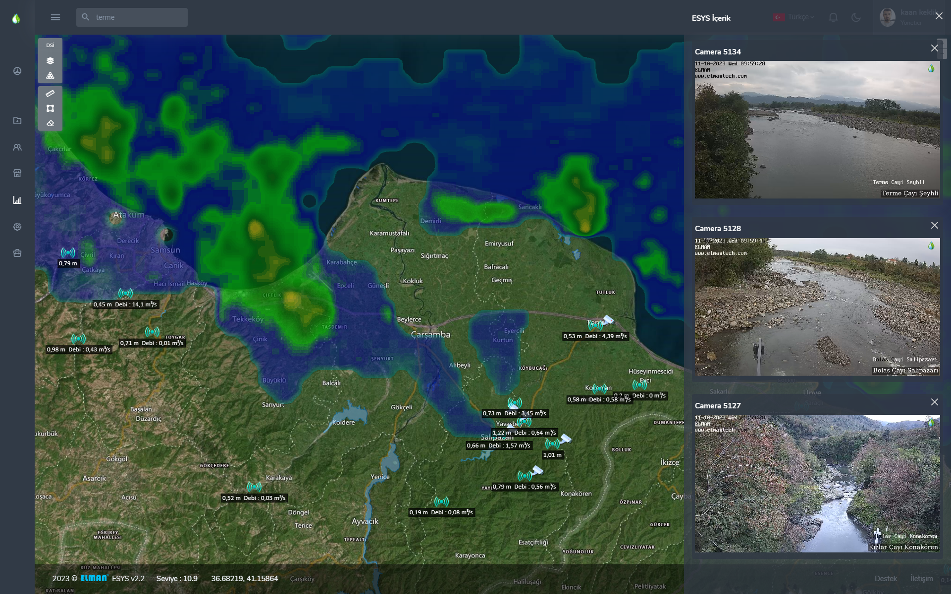
With the Weather Radar Layer, real-time rainfall distribution and predicted rainfall intensity data can be analyzed online, and the rainfall situation can be visually confirmed with live video connections to the relevant locations.
Additionally, the system allows for the real-time viewing of multiple camera feeds simultaneously, while also enabling concurrent monitoring and analysis of live data through the map interface.
In the project, critical points with potential flood risks have been placed under surveillance using cameras. Additionally, the real-time flow rates of each point are displayed on the map. This system, designed to provide early warnings and alerts for disaster risk, is the first of its kind in Turkey, offering technical support to relevant authorities. The intellectual property rights, software, and most of the hardware have been developed using domestic resources. This project contributes to ensuring public safety and protecting life and property. With these features, the system offers comprehensive control over the field with up-to-date data, strengthening decision-making mechanisms with an unparalleled level of early warning capability for timely intervention in flood events.
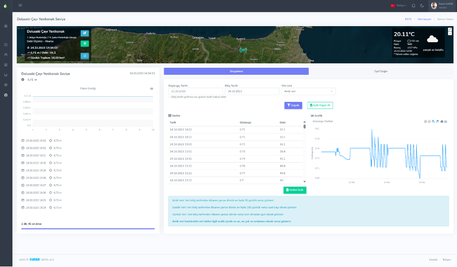
Data from the installed stations can be monitored in real-time on the map, and by selecting a station, users can perform data analysis and generate reports for any chosen date range. Monthly reports for the stations can be easily obtained with a single click through the system.
With the creation of the Flood Propagation Map software infrastructure, the system can detect rapid increases in water levels and flow rates during heavy rainfall. These changes are measured in real-time starting from the source point. The system will simulate potential flooding on the downstream side based on software calculations, estimating the flood time and flow rate. Alerts will be sent to the designated system authorities in advance, notifying them of the expected flood event.
TEUS® Elman Ltd Şti’nin Tescilli Markasıdır. İzinsiz kullanımı durumunda hukiki işlem başlatılacaktır.