Samsun Flood Early Warning Project
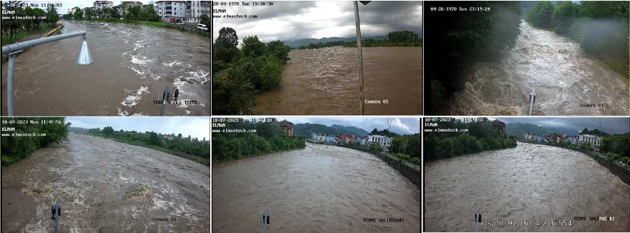
It is Turkey's most successful flood management system. It provides live video support from 6 stations for measurements taken at 35 different points. The system alerts responsible personnel in case of critical findings. It has been developed to protect human life.
ESYS FLOOD EARLY WARNING SYSTEM
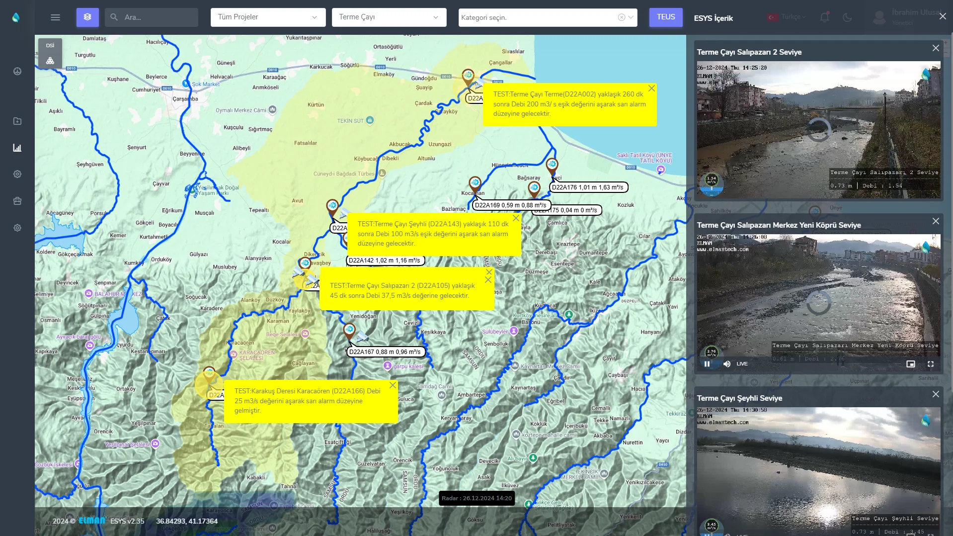
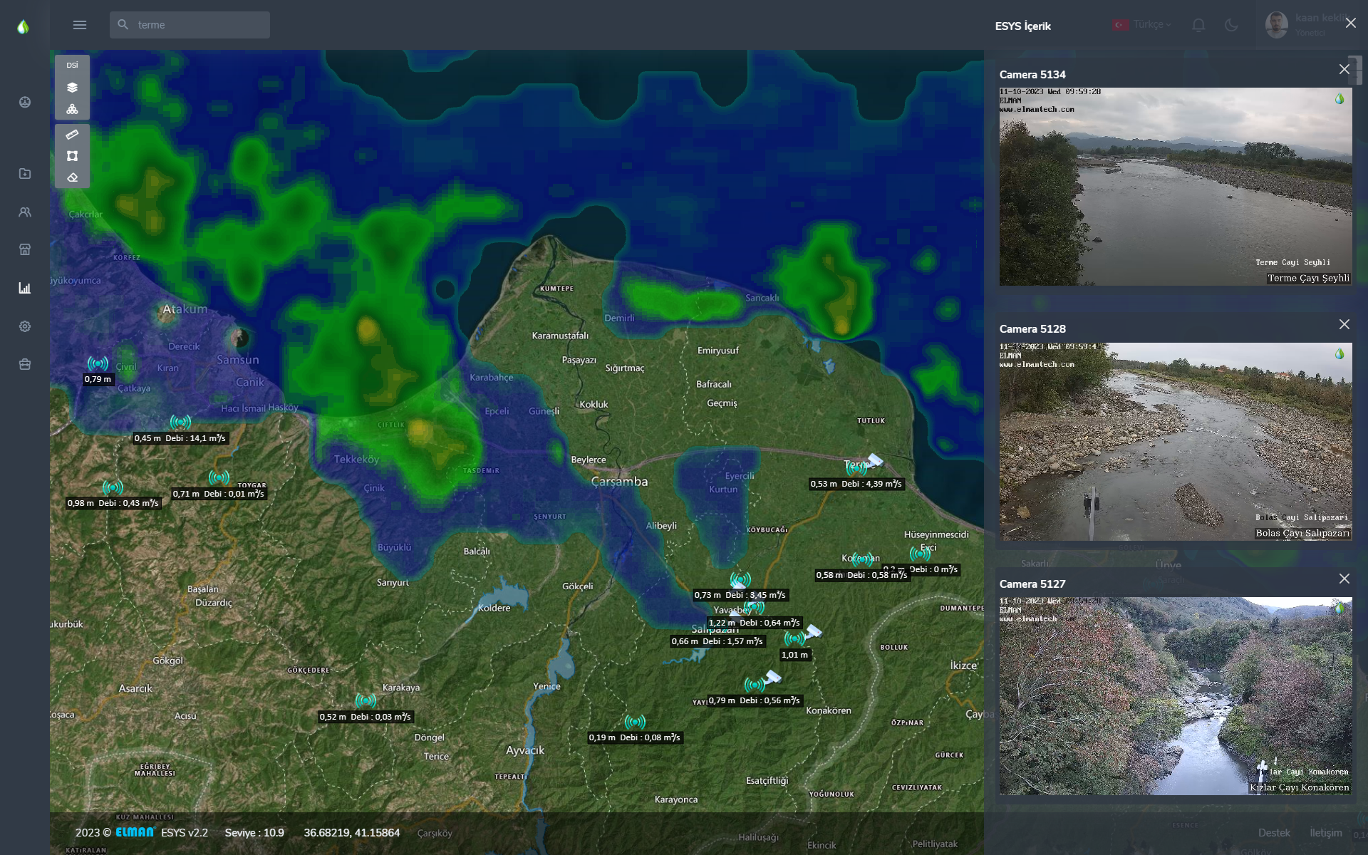
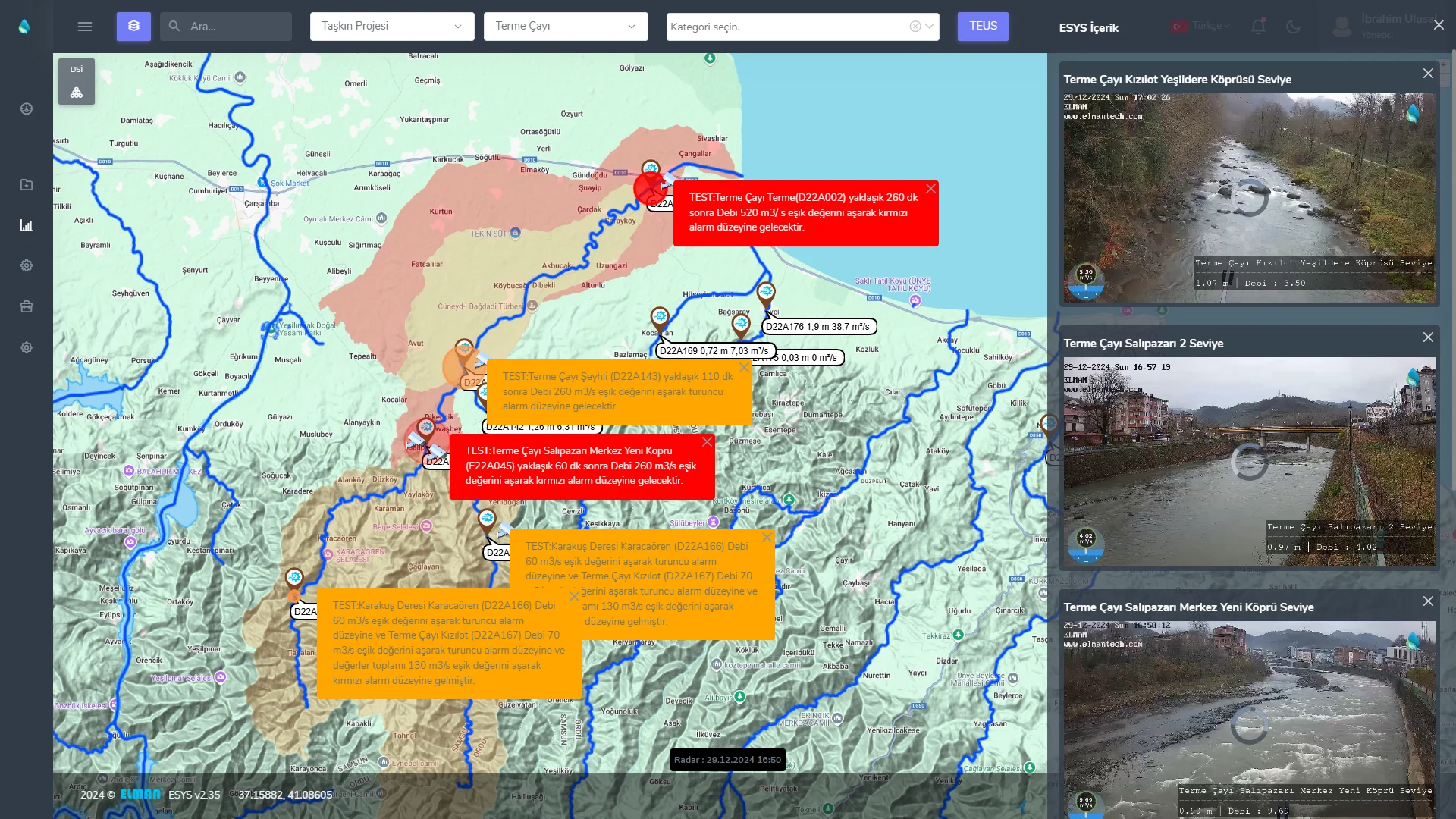
Türkiye’nin ilk canlı görüntü izleme yeteneği olan taşkın erken uyarı ve ihbar projesi olarak hayata geçirilmiştir. Taşkın riski yaratan 35 farklı nokta online olarak gözlemlenebiliyor. Kritik öneme sahip 6 noktada kamera ile canlı görüntü aktarımı yapılmaktadır. Oluşturulan bu sistem ile taşkın riski bulunan akarsuların memba noktası ile mansap noktası arasında temassız su seviye ölçüm sistemleri kurulmuş olup, bu noktaların en kritik olanlarına da ek olarak canlı görüntü izleme sistemleri entegre edilerek taşkın noktalarında görsel hakimiyet sağlanmıştır.TEUS hem Hidrolojik, hemde Meteorolojik verileri anlık olarak gözler. Bunlara ek olarak kritik noktalardaki kameralarla gerçek zamanlı görüntü işleme ve görüntü aktarma yeteneğine sahiptir. Böylece anlık olarak çapraz kontrol yapılabilmektedir.
Weather Analysis with Instant Rainfall Data and Visual Verification
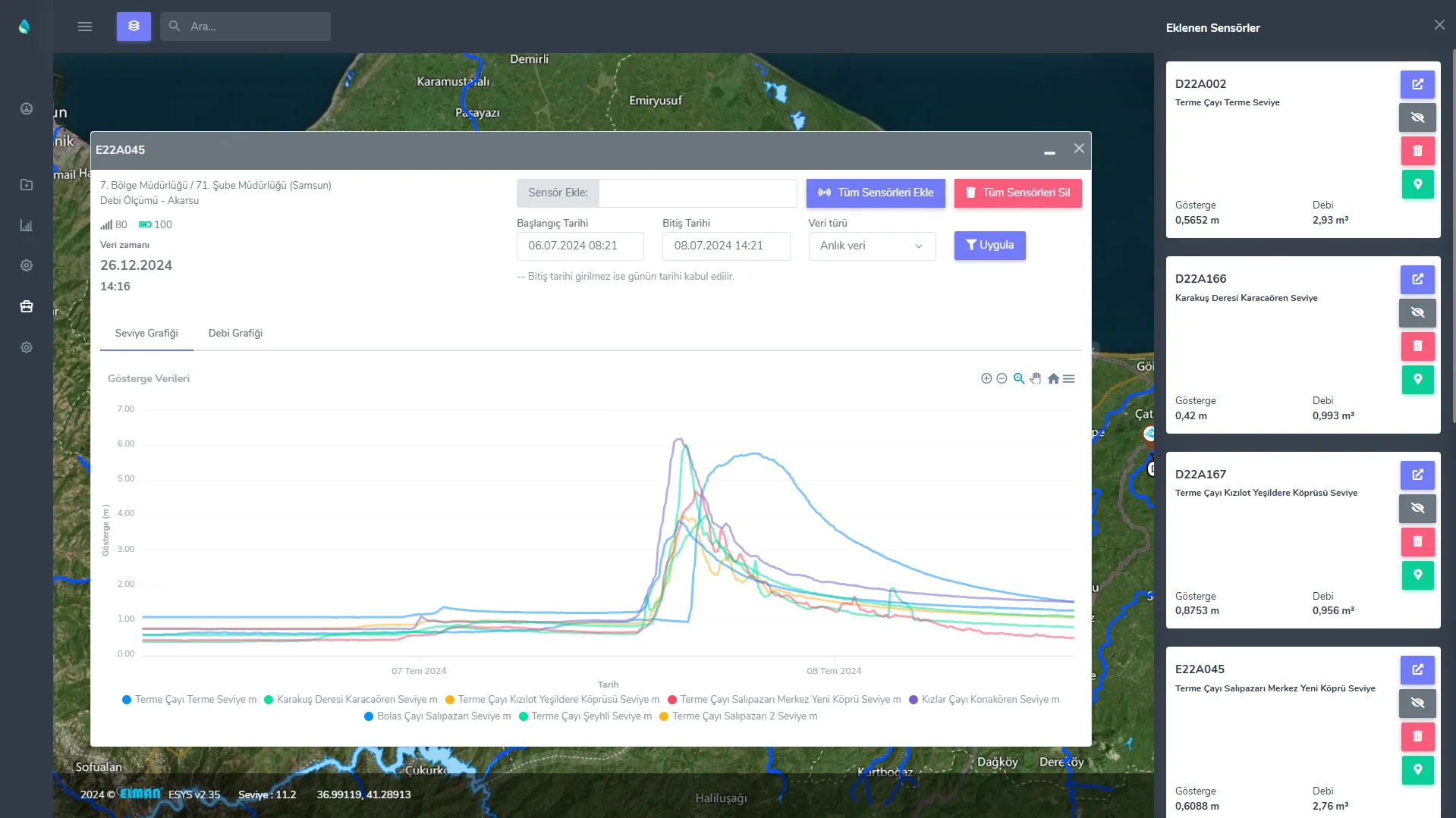
With the Weather Radar Layer, we can analyze instantaneous data regarding instantaneous precipitation distribution and estimated instantaneous precipitation intensity online and we can also visually confirm the precipitation status with a live video connection to the relevant points. In addition, instantaneous images of more than one camera point can be viewed simultaneously through the system, and monitoring and analysis can be made regarding instantaneous data tracking on the map simultaneously. Data regarding the established stations can be followed instantly on the map and data analysis/reporting can be made regarding any two selected date ranges retrospectively by selecting the station. Monthly reports regarding the stations can be obtained with a single click on the system.
Project Implementation Stages
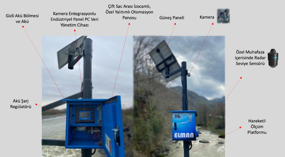
1. Stage Local Flood Monitoring and Early Warning System
Within the scope of the project, critical points where flood risk may occur have been monitored with cameras. In addition, the instantaneous flow rate of each point is also shown on the map. It is the first system in our country designed to provide technical support to relevant units regarding early warning and alert against disaster risk. The project intellectual property rights and software and most of its hardware have been produced with domestic resources. It is a project that supports the protection of public life and property safety. With these features, it offers full control of the field with multi-faceted up-to-date data. It significantly strengthens decision support mechanisms with its unique early warning opportunity in terms of supporting those responsible for early intervention in flood processes.
2. Stage Instant Flood Forecast and Early Warning System
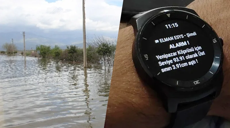
With the creation of the Flood Propagation Map software infrastructure, the system can detect rapid increases in water levels and flow rates during heavy rainfall. These changes are measured in real-time starting from the source point. The system will simulate potential flooding on the downstream side based on software calculations, estimating the flood time and flow rate. Alerts will be sent to the designated system authorities in advance, notifying them of the expected flood event.
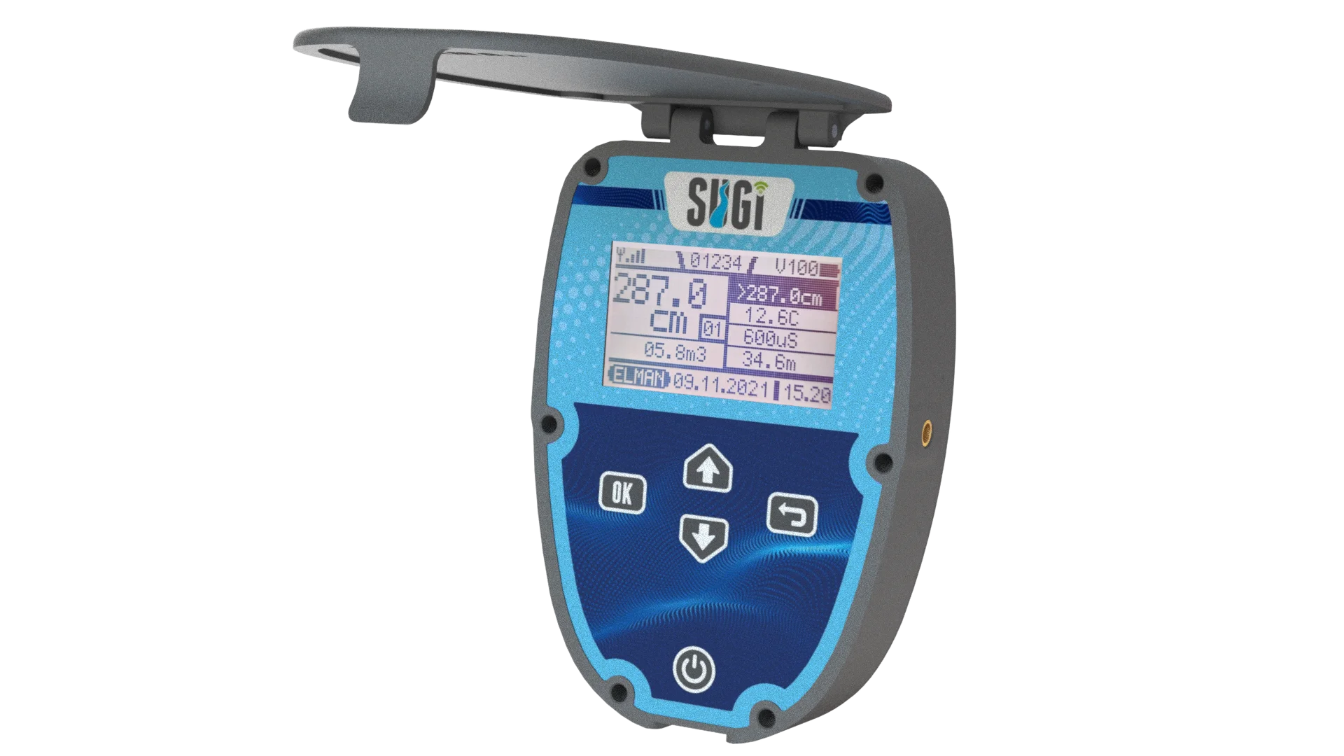
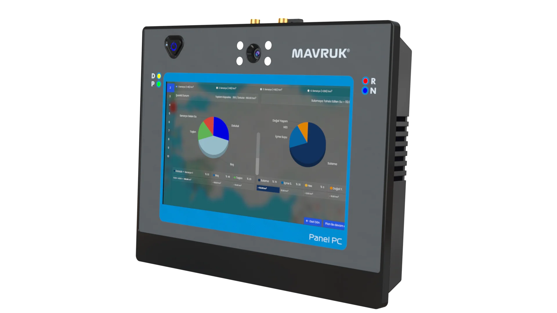
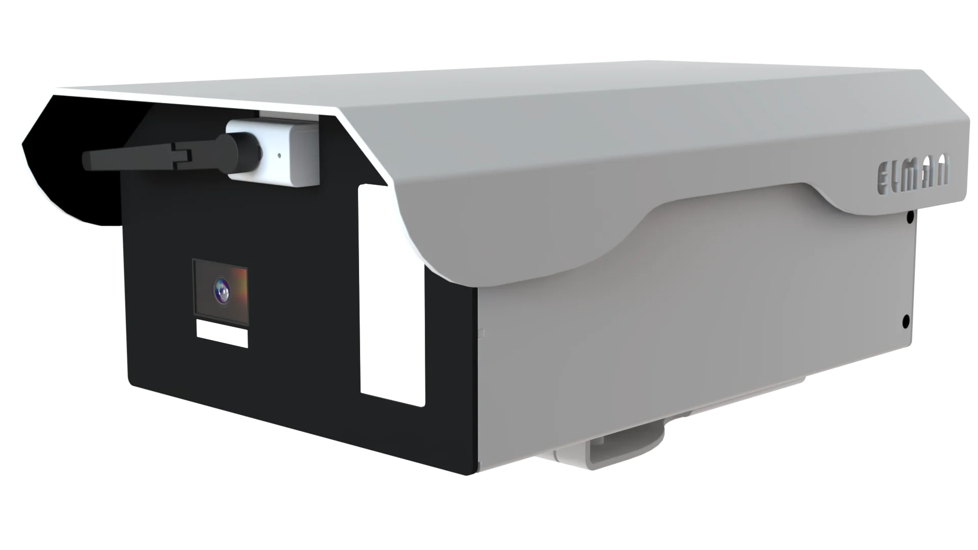
Samsun Flood Early Warning Project Products We Use